Showing posts with label earth. Show all posts

Sunday, September 7, 2025

Phone astrophotography

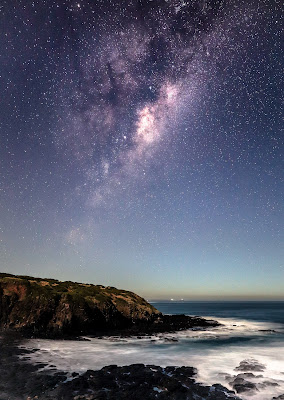
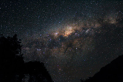
 Phone cameras have come a long way and are inching closer to the capabilities of DSLR and mirrorless cameras when it comes to astrophotography. Improvements in sensor technology and built in post processing features such as HDR, stacking and star alignment being have made them into a useful backup or even a viable replacement for traditional cameras, especially when used with a tripod. These days, I find myself using my phone more than my DSLR for milky way photography.

The photos that follow are some of my favorite shots of the milky way and landscapes taken using an iPhone 14 pro, on tripod with the maximum 30s exposure in the built-in camera app, and later edited in Lightroom mobile. 

The above was taken at Lerderberg State Park Victoria aiming directly at the zenith around the end of winter. 


These two photos were taken in Point Lonsdale lighthouse. The red light from the lighthouse lit up the surrounding rock formations in red as seen in the top image. What is also interesting is that the second image would not have been possible on a single exposure on a DSLR, as the light from the lighthouse would have washed out the image. It appears that the phone has automatically stacked images of various exposures to create a composite image.


These images were taken at the Gravity Observatory in Perth. While a lot of stars are visible the image contains a lot of noise highlighted during the edits, possibly showing the limits of phone night photography.


The first two phots above were taken at Lake Tyrell, and third at the town of Sea Lake. In the second image, the moon illuminated the surroundings and overpowered the stars, but I was able to capture the reflections of a few stars on lake's calm surface. 


These two images are the latest ones taken at Aireys Inlet beach. The last one is my favorite so far since it highlights the details of the milky way as well as the rock formation. I used the flashlight from another phone to briefly light up the rocks while the image was being exposed for 30s, and in my opinion it resulted in perfect exposure of both landscape and the stars. 

While phone cameras have made impressive improvements and deliver impressive results, DSLR and mirrorless systems continue to advance in their own right. Still, smartphones offer unmatched accessibility and portability - and as the saying goes, "the best camera is the one you have with you".


Saturday, May 11, 2024

Southern lights in Victoria

It's usually not easy to catch a glimpse of Aurora Australis, the southern lights, from Victoria. Tasmania and New Zealand are better places to be. The occasions when it is visible from in Victoria, it's best seen from the southern coasts of the state and usually appears as a faint glow to the naked eye. My last post on astrophotography had a picture of the southern lights taken from Flinders. But with the intense geomagnetic storm yesterday auroras were expected to be visible from many parts of the world. 

As soon as I got to know this I looked for the closest southernmost point, and being in the west of Melbourne, this was Kirk Point in Point Wilson. While driving there I was amazed to see the green and pink shifting columns of light to the naked eye while still on the highway, and stopped to snap a few pictures as soon as I took the exit. Afterwards we went to my intended location and was treated to the spectacular southern lights show. It waned off around 11pm but was still visible even from my backyard after reaching home around midnight. 

Some pictures are below:


Sunday, March 24, 2024

More blue water - why is the Nil Diya Pokuna blue?

On my last visit to Sri Lanka, I was keen on exploring some lesser-known attractions and decided to visit Nil Diya Pokuna (නිල් දිය පොකුණ) located close to Ella in the Uva Province. I was impressed and fascinated by the massive underground cave complex and the blue water pond at the end of the 850m hike through the cave. This was the second time I saw clear blue water in Sri Lanka, the first being in a limestone quarry.  

The usual reason for ponded water to appear bright blue or turquoise in colour is the fine particulates that selectively scatter light through water (the same reason why the sky is blue). In the case of the limestone quarry the fine particulates are minute calcite crystals and in the case of glacial lakes they are finely ground rock particles known as glacial flour. 

Nil Diya Pokuna has a very interesting geology, with several different rock types present around and within the caves, and I wanted to understand what gives the water its blue colour. Caves of this scale are usually formed by the action of weathering and erosion of sedimentary rocks such as limestone. However, this region of Sri Lanka consists of primary of metamorphic rocks. This blog post by Dr Jayasingha describes the geological origins of the cave complex containing Nil Diya Pokuna. According to it, the caves have been formed by the initial dissolution of Marble, which leads to weakening of rock joints and bedding planes and subsequent collapses of the other rock masses creating the large underground caverns. 

Marble is formed by the metamorphosis of limestone, and its dissolution would lead to the release of calcite crystals. There are stalactites formed at several places within the cave, as seen in the photos below, that confirm the occurrence of marble or limestone dissolution. Therefore, it is reasonable to conclude that the reason for the blue coloured water in Nil Diya Pokuna is the calcite crystals that are accumulated in the water as it flows through the joints and fissures in rock containing marble or limestone before making its way into the pond. Below are some photos from my visit:

Stalactites in the cave indicating marble or limestone dissolution
 
Evidence of weathering and staining in the rock

Visible bedding planes and smooth joint surface of a possible collapse leading to cave formation

Blue water and more stalactites

High water levels were blocking off some more expansive areas of the cave

The water was a little murky due to recent rains


Sunday, November 13, 2022

More pictures looking to the heavens

Back in 2017, I wrote a post on beginner astrophotography as I was just getting into the hobby. It was mostly a collection of my very first Milky Way pictures that I took at the time. Since then I have been taking more pictures of the Milky Way, and some occasional pictures of the moon, planets and the aurora. So here's an update of my latest selected pictures in the same format as last time, with details in the caption.

This picture was taken at Cape Schanck, one of my favorite places to capture the stars. It's a single exposure with light painting, so the staircase is out of focus. 

One of may favorite pictures taken under perfect conditions. Moon was out on the opposite side of the Milky Way to illuminate the landscape perfectly. Location: Flinders

This is the first picture in which I was able to capture the reflection of the stars in water. Location: Lake Eildon. 

The daytime moon captured through my telescope. I attached the camera into the eyepiece of the telescope with a lens adapter. 

Two photos of Jupiter and Saturn also taken from my telescope. I recorded a short video and processed it using PIPP and AutoStakkert to create these images. Haven't done planetary imaging since, but I do hope to try it out again sometime soon. 

A photo captured from my balcony one evening showing earthshine on the moon. 

The rising moon captured using a telephoto lens without a tripod. 

My first attempt at capturing star trails. This is a single exposure taken over approximately 12 minutes. Photo taken at Lake Eildon. 

This is my first attempt to capture the Aurora. The pink glow is the Aurora Australis seen from the Southern Coast of Flinders. 

This picture shows the recent lunar eclipse- the blood moon, as seen from Flinders shortly after sunset on 8 November 2022. 


Sunday, August 26, 2018

More turquoise water

Back in 2014 I was fascinated by the bright turquoise water that emerged from a base excavation at the Aruwakkalu limestone mine in Sri Lanka. I was doing my undergraduate internship at the time and was so intrigued that I researched into the phenomenon and wrote a blog post explaining how the turquoise colour emerges due to selective scattering of light caused by calcium carbonate crystals. A picture that I took was also featured in the Mining magazine. Four years later I came across the striking turquoise water again.

I am currently a visiting research student at the University of British Columbia, Canada and recently visited some glacial lakes in British Columbia. I got to see once again, the bright turquoise colour that intrigued me 4 years ago. The reason behind the turquoise colour is the same selective scattering of light. This is caused however, not by calcium carbonate crystals but by glacial flour/rock flour, which is the name given to very fine rock particles generated by glacial erosion, and remain suspended in the water. The lakes I visited were the three Jofrre lakes and Garibaldi lake, where I even went for a relaxing swim. Some pictures that I took at the lakes are below.

Upper Joffre Lake

Middle Joffre Lake

Garibaldi Lake

Garibaldi Lake


Tuesday, September 5, 2017

Astrophotography on a budget

Astrophotography is thought to be an expensive hobby to pursue involving lots of high-tech and expensive equipment. I was under the same impression and was concerned of this steep entry barrier. Then I came across this blog-Lonely Speck by Ian Norman, who in my opinion, is a very creative photographer and does an excellent job of explaining the basics of photographing the stars. This blog got me started and I started reading online forums and learning about the hobby.

I gathered that new sensors in most cameras-even entry level ones are perfectly capable of capturing the milky way. Any DSLR or compact camera with manual controls can be used to gather enough light over a long exposure to shoot the night sky. So I bought my first DSLR, a Canon 1300D and a basic tripod for about 500AUD. This is an entry level camera and is one of the cheapest DSLRs in the market. Some blog posts and YouTube videos later I set off in search of dark skies.  

After a couple of attempts I am very happy with my results and have even got better results than some photos that I drew inspiration from. I'm still learning and hoping to improve on my methods and results. The usual process I follow to shoot the stars is, waiting for a day with clear skies, checking the moon phase, the position of the milky way and selecting a dark location without much light pollution.  The pictures below are some of my best shots taken up to now, with a little description on the story behind the shot. 

My first attempt at shooting the Milky Way. The stars are out of focus and not a very good image, but was a valuable learning experience. Location:Paradise beach Gippsland


These three shots were taken at Silvan Dam Olinda. The first using the 18mm kit lens and the other two using a 50mm prime lens at f2.0 borrowed from a friend.  

My first shot of the galactic core taken at the Cape Schanck beach. It was a misty day with plenty of moonlight to illuminate the landscape. But the milky way was very faint. 

Clearly visible galactic core taken at Olinda

Another shot of the galactic core taken at Wilsons Prom under moonlight.
This shot was also taken at Wilsons Prom after the moon set. This was the best naked eye view of the Milky Way I've experienced up to now. 
This shot taken at Olinda is one of my favorites because of the unintentional effect of light painting. A car passed by during exposure and it illuminated the tree and a power line nearby, giving the photo a more balanced look.  


Sunday, September 22, 2013

Global Tidal Variations Explained

Tides are periodic variations of the ocean surface caused by the gravitational attraction of the moon and the sun. On a fundamental level, tides can also be considered as waves. Since these tidal waves have extremely long wavelengths, they are essentially shallow water waves(Shallow water waves are waves which travel over depths lower than 1/20th their wavelength). This means that the speed of the tidal wave is proportional to the depth. The depth of the ocean basin, the time of year and month, latitude and earth's rotation affect the type and magnitude of tides. While the exact relationship between all these variables can be somewhat complex, certain scientific theories and models help simplify and explain the behavior of tides.

Depending on the occurrence of high and low tides, tidal patterns are classified into three types. These are,
1. Diurnal tides
2. Semi-diurnal tides
3. Mixed Tides.
If the tidal wave shows 1 crest and 1 trough within a period of 1 lunar day(24hrs and 50mts), then it is called a diurnal tide. If it shows two crests and two troughs or vice versa in one lunar day, it is called a semi-diurnal tide. Mixed tides are a mixture of these two, often with significantly different amplitudes.

While tidal variations can be attributed to the gravitational attraction of both the sun and moon, the effect of the moon is significantly larger. "The Equilibrium theory of tides" attempts to explain these variations with the following assumptions.
-the ocean is indefinitely deep
-no land masses are present
-no inertial forces
With these assumptions, the key tide generating forces are, gravitation and centripetal force. These two forces act differently on different locations on the earth. While the gravitational force directs to the center of the moon, the centripetal forces at different locations are parallel to each other. This is because, centripetal force is the force that keeps an object in circular orbit, and the different locations have their own circular orbits parallel to each other.

Source : Trujillo,Alan P.Essentials of oceanography / Al Trujillo, Harold Thurman. 10th ed.

The gravitational attraction provides the required centripetal force to keep the earth in orbit. However, the gravitational attraction and the required centripetal force are unequal at different locations on the earth. These two are equal only at the center of the earth. The difference between these two forces creates a resultant force which acts as shown in the diagram. It is this resultant force that is responsible for the generation of tides. This is also why, tidal bulges appear on both sides of the planet, because the resultant forces at the two sides of the earth are oppositely oriented. 

The orbital plane of the moon is inclined by approximately 28.5 degrees to the earth's axis of rotation. This causes the tidal bulges also to orient as shown below. The earth rotates through these tidal bulges. This explains the occurrence of diurnal and semi-diurnal tidal patterns explained above. By inspecting the diagram below it can be seen that high latitude locations receive diurnal tides, equatorial regions receive semi-diurnal tides and mid latitude locations receive mixed tides. 

Source : Trujillo,Alan P.Essentials of oceanography / Al Trujillo, Harold Thurman. 10th ed.

This shows how the equilibrium theory explains the occurrence of the diurnal and semi-diurnal tides. This means that, tidal patterns on earth should be related to latitude. According to the above diagram it is also seen that tidal heights should also vary with latitude, with the highest tidal heights in mid latitude regions. However, the following tide map of the world shows that no such connection between tidal characteristics and latitude can be observed. This is where the equilibrium theory of tides fails.

-world tidal patterns- Source : Invitation to oceanography / Paul R. Pinet. — 5th ed.

The equilibrium theory of tides does not take into account the depth variations of the ocean basins. It also neglects the effect of the earth's rotation. To overcome these issues, another theory, "The Dynamic Theory of Tides" was proposed. Proposed in the 18th century by Pierre Simon Laplace, it attempts to explain tidal variations with the Coriolis Force.

To illustrate this theory, consider a large rectangular ocean basin in the northern hemisphere. when the water level rises in the upper portion of the basin due to the tidal action, the Coriolis force deflects the mass of travelling water towards the right. this causes the water to build up in the upper right corner of the basin. The resulting pressure gradient causes the water to flow downwards, but is again deflected to the right by the Coriolis force. This cycle continues, and it results in a counterclockwise oscillation of the water mass. The nodal point where the water does not oscillate is known as an "Amphidromic Point."

Source : Invitation to oceanography / Paul R. Pinet. — 5th ed

If the ocean basin is situated in the southern hemisphere, the Coriolis force will deflect the water towards the left side, and the resulting oscillation would be clockwise. While ocean basins found on earth are not ideal basins like the above explained, several Amphidromic Points can be identified in the earth's oceans through tidal action. This amphidromic system of tides better explains the tidal variations depicted in the above tidal map. Since the amphidromic system is an oscillatory system, tides can undergo resonance. If the natural period of the ocean basin equals the period of the tides, tidal resonance will occur creating a massive tidal wave. An example of this is the Bay of Fundy where tidal ranges of over 17metres have been observed.

Global Amphidromic Points - Source : Invitation to oceanography / Paul R. Pinet. — 5th ed
The depth of ocean basins also affect tidal heights. As explained above, tides being shallow water waves, have speeds that are proportional to depth. This means that a lower depth would cause the tidal wave to slow down, and due to the conservation of energy, the amplitude of the wave would increase, thus creating a higher tide. Taking all these factors into consideration, tides can be accurately modeled and predicted.

This understanding of tidal action opens up means of using it as an energy source. In places where a high tide variation is present, tidal energy can be tapped into by building dams to trap the incoming tidal flood current, and then channeling them through turbines like in a hydro-power plant. Power plants of this type are already in operation around the world, an exmaple is the La Rance tidal power plant at St. Malo, France. Tidal power plants do not pose a significant threat to the environment and are therefore are a good alternate source of renewable energy.


Saturday, July 28, 2012

Was Banning DDT a Mistake?

Banning of the pesticide DDT is often credited as one of the best decisions made for the betterment of human beings and the environment. However this decision has also led to more than 30 million deaths since it was implemented. It was a decision made without any scientific basis and has resulted in irreparable losses in developing countries.

DDT was banned in 1972 by the EPA claiming that DDT is a carcinogen and has harmful effects if exposed to the environment. Public support for this cause came by means of a then best selling book by Rachel Carson, known as "Silent Spring". However it has been found out that Silent Spring was not based on sound scientific findings and also that the decision made by the EPA to ban DDT was based on fraudulent reports and was a result of bureaucracy.

DDT was a very effective pesticide that was used to control malaria. Countless scientific experiments have reported that DDT has no harmful effects on humans or nature. But apparently these scientific findings have not been considered when deciding to ban the said pesticide that ultimately led to millions of deaths. The negative effects of banning DDT is most felt in developing countries. For instance, in Sri Lanka alone, spraying of DDT has reduced the number of malaria cases from 2.8 million in 1948 to 17 in 1963. After the ban was imposed, the number has risen again to 2.5 million.
(source : http://dwb.unl.edu/Teacher/NSF/C06/C06Links/www.altgreen.com.au/Chemicals/ddt.html)

The actual reasoning behind the decision to ban such a useful pesticide is not known. Developed countries don't feel the impact of it as much as the developing countries do. In spite of this, forcing developing countries also to ban DDT is clearly not justified. Just like most cases in the modern world, it seems the agency behind this decision had its own agenda and gains to make from such a decision.

More information : http://www.jpands.org/vol9no3/edwards.pdf

Saturday, April 21, 2012

Beach Nourishment

Beach nourishment also called beach replenishment, is the replacement of sand lost due to erosion by sources outside the eroded beach. This helps minimize damage from storm surges, tides and tsunamis. Beach nourishment does not stop erosion.  It only mitigates its effects while eroding away the sand used in the nourishment process and eventually bringing the beach back to its original pre-nourished state. Because of this reason beach nourishment is a repetitive process. After all the "new" sand has eroded away, the beach will have to be re-nourished. While this method helps protect coastal areas it usually is very costly.

beach nourishment : image credit : wikipedia